The sky outside is hazy orange, and my five-year-old son is screaming bloody murder. “Sorry, buddy, we have to stay inside,” I say. “It’s not safe to breathe out there.” I had told him we’d be going to the beach today. Something inside me tears a little as I wonder how many promises he’ll see similarly broken in the coming years.
Far too many parents were forced to have some version of this conversation with their children this month, as smoke from record-breaking wildfires poured across the midwest and north-east. Some of them already had to tell their kids that their Fourth of July festivities were canceled because of the lethal heatwave that caused numerous mass casualty events earlier this month.
According to scientists, these extreme weather events are not “natural” disasters. A team of researchers already published a study finding that the Fourth of July heat wave would have been “virtually impossible” but for the climate crisis. Other studies – using methods recently validated by the National Academy of Sciences, the country’s top scientific advisory body – found that the pollution from individual big oil companies such as ExxonMobil, Chevron, Shell and BP made some past climate-exacerbated heatwaves at least 10,000 times more likely compared with preindustrial levels.
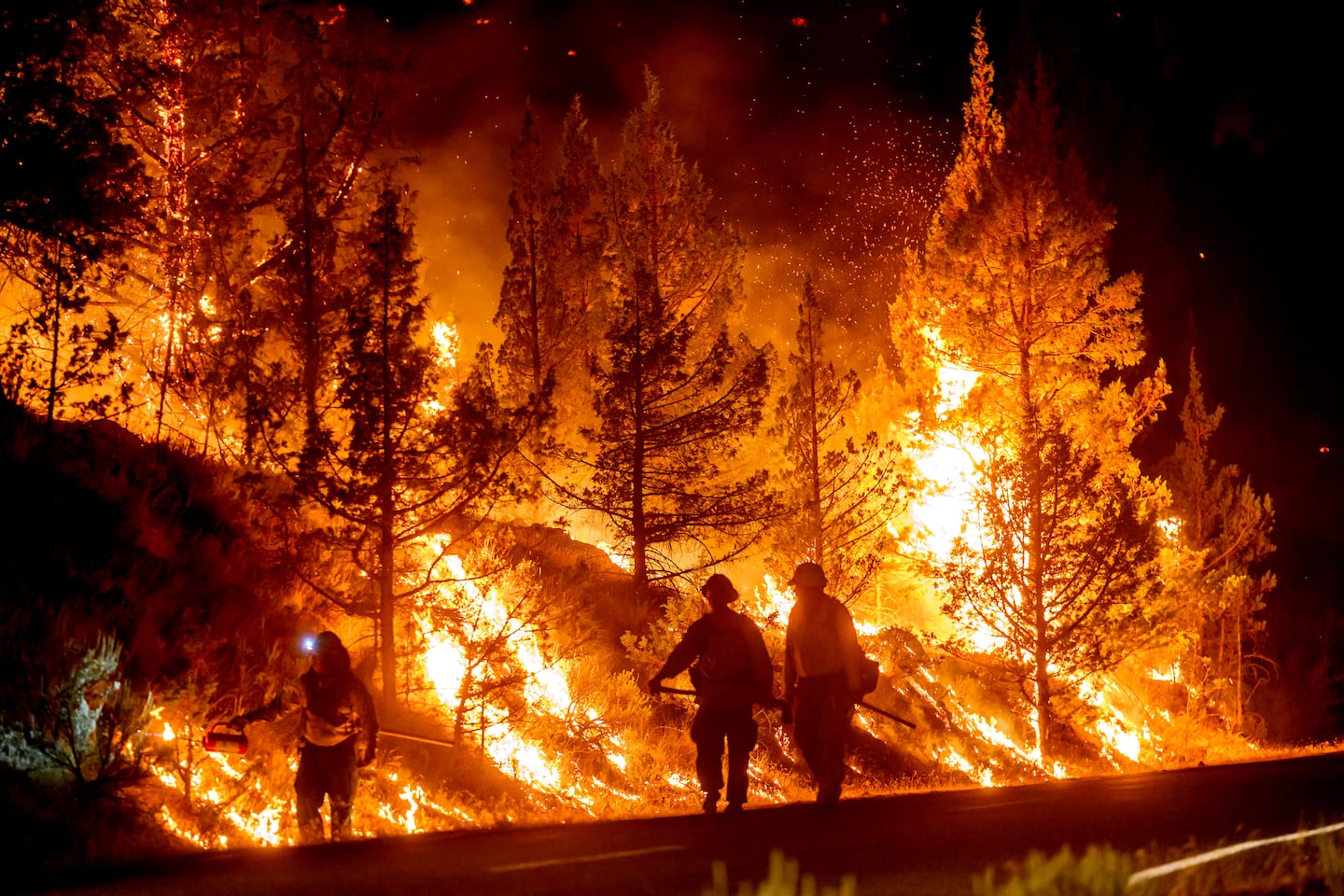 Large swaths of Central Oregon have become consumed by wildfire, with several blazes burning across the region simultaneously, forcing thousands to evacuate and further stretching the state’s limited firefighting resources.
 A tornado struck north-eastern Wisconsin on Monday, blackening the midday sky and sending workers sheltering in office basements as ferocious winds splintered homes, scattered twisted metal across a highway and knocked out power to more than 30,000 people.
 At least 40 million people were under extreme heat warnings across central and southern parts of the United States on Sunday as high temperatures and severe humidity gripped large swaths of the country for a second straight day.
 Tropical Storm Bertha formed Monday evening in the Gulf of Mexico south of the Florida Panhandle as it drifts erratically toward populated coastal areas, bringing a threat of heavy rain, storm surge and damaging wind gusts.
 Five family members who had set out for a day of hiking were killed after a flash flood swept through canyons of southern Utah on Friday, law enforcement officials said.